
Monteverde Institute: Sustainable Design, Planning and Community Development
This collection contains proposed designs and planning documents to assist in Sustainable Community Development, based on issues identified as important by the community. Many of the projects in this collection come from the Sustainable Futures Summer academic program at the Monteverde Institute.
This digital collection is a service of the Monteverde Institute, whose mission is to catalyze social, ecological and economic sustainability by integrating community initiatives with education, research and conservation.
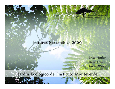
Esta colección contiene diseños propuestos y documentos de planificación para ayudar en el Desarrollo Comunitario Sostenible, basados en temas identificados como importantes por la comunidad. Muchos de los proyectos de esta colección provienen del programa académico de verano Futuros Sostenibles del Instituto Monteverde.
Esta colección digital es un servicio del Instituto Monteverde, cuya misión es catalizar la sostenibilidad social, ecológica y económica integrando iniciativas comunitarias con educación, investigación y conservación.
-

Goals for the District of Monteverde, 2004
Monteverde Institute
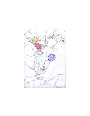
Goals for the Monteverde District: promote diverse economic opportunity, protect the environment, provide efficient and diverse transporation, promote educational opportunities, and provide recreational opportunities. Patterns for the Monteverde District: Hierarchy of town centers, public life, pedestrian safety, public transportation, green networks.
-

Grupo Tres: 1 de 2, 2004
Monteverde Institute
Hand-rendered map of San Luis, with legend, surrounded by images of structures in the town. Each image is numbered with its corresponding number located on the map.
-
![Introduction to the communities of Monteverde and Cerro Plano [PowerPoint], 2004 by Trent Jones](https://digitalcommons.usf.edu/sustainable_futures/1086/thumbnail.jpg "Introduction to the communities of Monteverde and Cerro Plano [PowerPoint], 2004 by Trent Jones")
Introduction to the communities of Monteverde and Cerro Plano [PowerPoint], 2004
Trent Jones
Description of the Monteverde and Cerro Plano communities as a basis for scenario planning.
-

Maps--Cerro Plano, 2004
Monteverde Institute
Hand-rendered maps of Cerro Plano, including community centers, forest cover, institutional buildings, recreational locations, residential neighborhoods, and views.
-

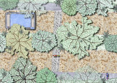
Master plan of San Luis, 2004
Monteverde Institute
Hand rendered drawing of master plan for San Luis.
-
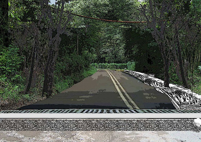
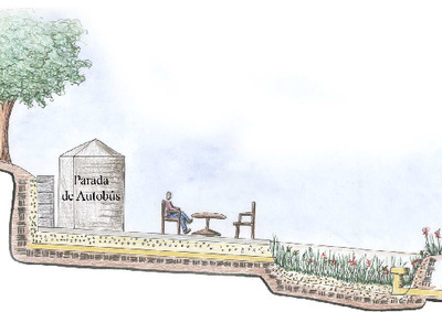
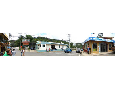
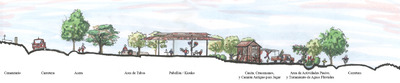
![[Monteverde] center perspective, 2004](https://digitalcommons.usf.edu/sustainable_futures/1304/thumbnail.jpg "[Monteverde] center perspective, 2004")
[Monteverde] center perspective, 2004
A hand-rendering of a possible scenario plan for the town center of Monteverde.
-

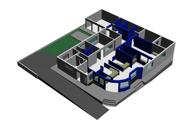
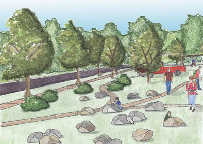
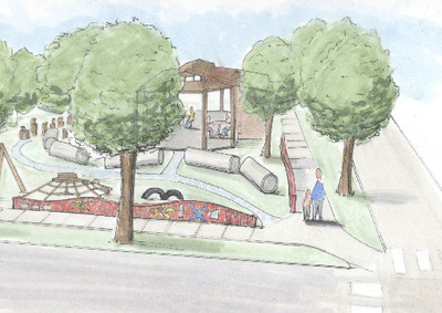
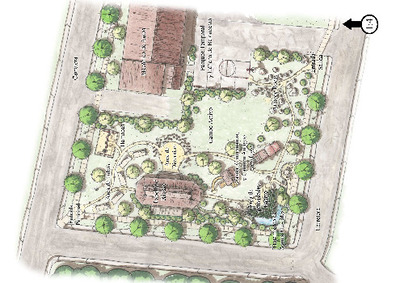
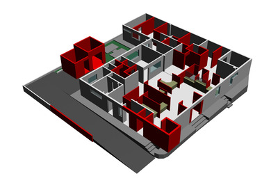
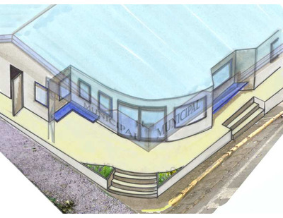
Monteverde Institute: Scenario Plan, 2004
Monteverde Institute
Nine hand-renderings of a scenario plan for the Monteverde Institute. Drawings include a 1st floor perspective, second floor perspective, elevation perspectives from the front and side (black & white) and side elevation perspective (color), the Institute as it exists, an existing floor plan, and front elevation, and an overall plan of the Institute (color).
-

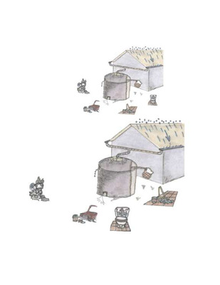
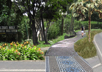
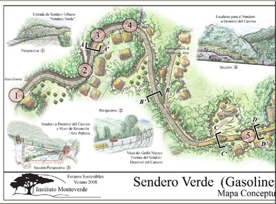
Pacific coast trail, 2004
Monteverde Institute
Images taken along proposed Pacific Coast Trail. Included are casa maple and FBL trocha.
-

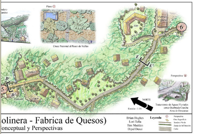
Pacific Coast Trail: Finca Buen Amigos trail--images, 2004
Monteverde Institute
Images from Sendero Pacifico, Finca Buen Amigo trail.
-

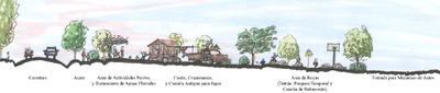
Pattern analysis for Monteverde and Cerro Plano, 2004
Monteverde Institute
A summary of the problems, discussion, and solutions in creating green neighborhoods and strong town centers, art and cultural facilities and activities, spaces for recreational activities, low impact eco-tourism opportunities, and preserving the rural character while balancing development.
-
![Planeamiento del escenario: ¿Que pasara en el futuro en San Luis? [PowerPoint], 2004 by Monteverde Institute](https://digitalcommons.usf.edu/sustainable_futures/1093/thumbnail.jpg "Planeamiento del escenario: ¿Que pasara en el futuro en San Luis? [PowerPoint], 2004 by Monteverde Institute")
Planeamiento del escenario: ¿Que pasara en el futuro en San Luis? [PowerPoint], 2004
Monteverde Institute
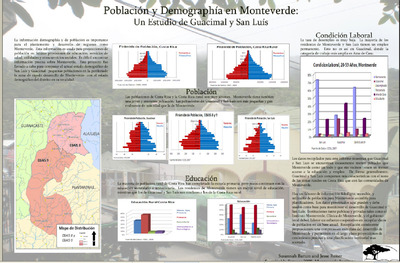
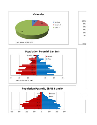
A presentation about the future of San Luis using scenario planning. Contains a reflexion of the goals of San Luis, the population projection, how a diversified economy could be made, and some recommendations for a sustainable future.
-

San Antonio, 2004
Monteverde Institute
GPSpoints, latitude, longitude and comments on locations in San Antonio.
-

San Luis: Collage, 2004
Monteverde Institute
Eighteen images are included in this collage: the quarry, erosion, coffee and plantain farm, La Bella Farm, a farm, construction, Eco Lodge, stable, cabins, bridge, the waterfall, the school, a bridge, the river, the generator and the cemetery.
-

San Luis housing: Individual housing development, 2004
Ashley Elder, Cynthia Gallant, Jonny Hayes, and Christina Weber
A hand rendering of an individual housing development for San Luis. Six images of the area are included.
-

San Luis housing: INVU neighborhood development, 2004
Ashley Elder, Cynthia Gallant, Jonny Hayes, and Christina Weber
A hand rendering of a proposed neighborhood development plan for San Luis.
-

San Luis housing patterns, 2004
Monteverde Institute
Hand-rendered drawings of the cemetery, before and after plans for denser housing to allow for more open space, the plaza and the overall aerial view of the proposed plan.
-

San Luis housing: Plaza housing development scenario, 2004
Ashley Elder, Cynthia Gallant, Jonny Hayes, and Christina Weber
A hand rendering of a proposed plaza development scenario for San Luis, including a drawing depicting the character of the plaza housing development.
-

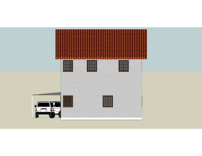
San Luis housing: Prototypical cabin, 2004
Ashley Elder, Cynthia Gallant, Jonny Hayes, and Christina Weber
Back, left side, and right side elevations; 2 floors
-

San Luis housing: Prototypical community, 2004
Ashley Elder, Cynthia Gallant, Jonny Hayes, and Christina Weber
A hand rendering of a prototypical community of San Luis, including a character sketch of the plaza community and a typical community section.
-

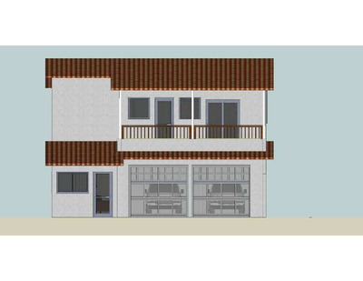
San Luis housing: Prototypical housing 2, 2004
Ashley Elder, Cynthia Gallant, Jonny Hayes, and Christina Weber
Prototype housing plans with right side elevation, longitudinal view, and front elevation.
-

San Luis housing: Prototypical housing I, 2004
Ashley Elder, Cynthia Gallant, Jonny Hayes, and Christina Weber
A technical drawing depicting a prototypical house, including a cross section, longitudinal section, floor plan, the front elevation, left side elevation and right side elevation.
-

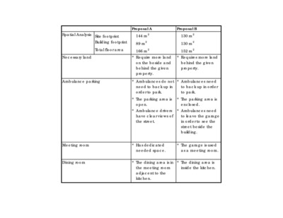
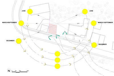
San Luis housing: Site selection, 2004
Ashley Elder, Cynthia Gallant, Jonny Hayes, and Christina Weber
Poster illustrating the issues involved in creating housing communities that also allow for biological corridors and sustainable community living.


