
Early Printed Map Collection
Files
Download Full Text (6.9 MB)
Preview
Creation Date
January 1752
Abstract
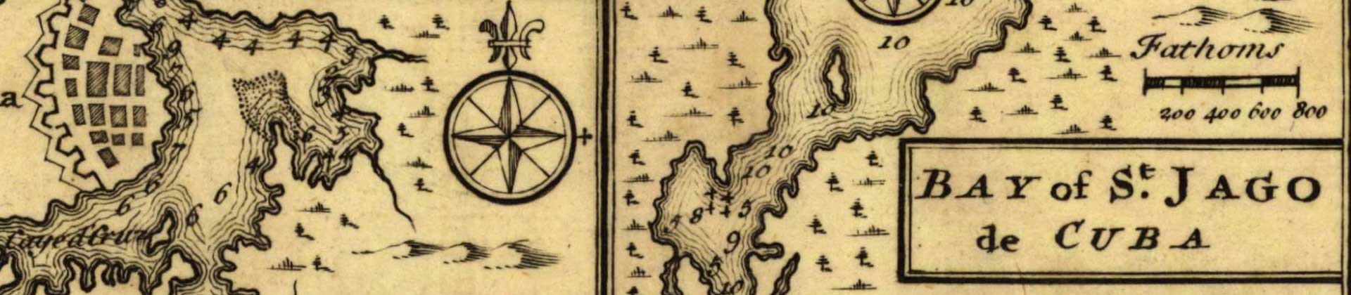
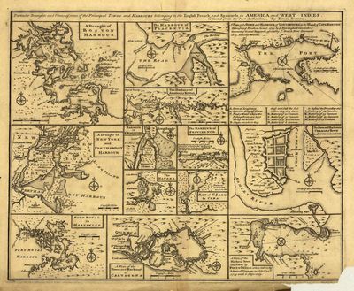
A series of thirteen small maps on one page of the harbors in North America including the United States, Canada, Cuba, Martinique, Colombia, and Panama. Includes maps for the harbors of Boston, Placentia, Annapolis, Louisbourg, Charleston, Providence, St. Augustine, Havana, Santiago de Cuba, New York, Fort Royal, Cartagena, and Portobelo (written as Porto Bello on the map).
Alt Text
Single graphic showing 13 individual maps including Boston, Placentia, Annapolis, Louisbourg, Charleston, Providence, St. Augustine, Havana, Santiago de Cuba, New York, Fort Royal, Cartagena, and Portobelo.
Keywords
Harbors
Extent
1 map
Subject: geographic
Canada; Cuba; Martinique; Boston (Mass.); Placentia (N.L.); Annapolis (Md.); Louisbourg (N.S.); Charleston (S.C.); Providence (R.I.); St. Augustine (Fla.); Havana (Cuba); Santiago de Cuba (Cuba); New York (N.Y.); Fort-de-France (Martinique); Portobelo (Panama)
Physical Collection
Rare Map Collection
Language
English
Media Type
Maps
Identifier
U16-0027
Recommended Citation
Bowen, Emanuel, "Maps, Particular Draughts and Plans of Some of the Principal Towns and Harbours Belonging to the English, French, and Spaniards, in America and West Indies, 1752" (1752). Early Printed Map Collection. Image 1.
https://digitalcommons.usf.edu/fl_maps_early/1
Keywords
Harbors
Rights Statement

