
Early Printed Map Collection
Files
Download
Download Full Text (9.0 MB)
Preview
Publisher
John and Paul Knapton
Creation Date
1748
Abstract
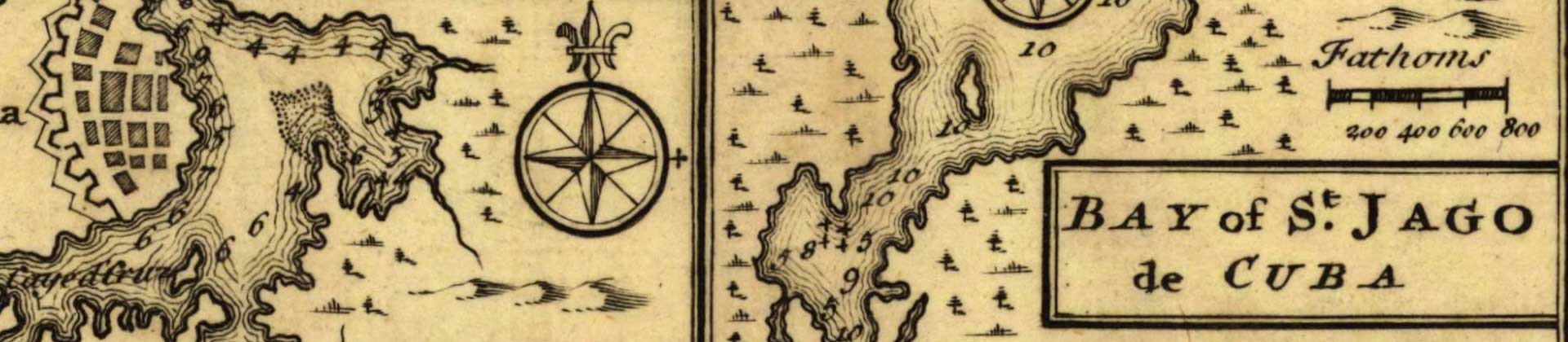
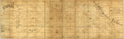
A nautical map of the Pacific Ocean from the Equator to the 39.5 Latitude line. Includes parts of the coastline of Mexico, California, the Philippines, and Japan as well as many South Pacific Islands.The path of the ship "Nostra Signora de Covadonga" is shown.
Alt Text
Nautical map depicting the Pacific Ocean between California and the Philippines. The path of the ship "Nostra Signora de Covadonga" is shown.
Extent
1 map
Subject: geographic
North Pacific Ocean
Physical Collection
Rare Map Collection
Language
English
Media Type
Maps
Identifier
U16-0108
Recommended Citation
Seale, Richard William, "Map, Chart of the Pacific Ocean from the Equinoctial to the Latitude of 39 1/2 No, 1748" (1748). Early Printed Map Collection. Image 21.
https://digitalcommons.usf.edu/fl_maps_early/21
Rights Statement

