

Dr. Garald Gordon Parker Collection - Images
Files
Download
Download Full Text (5.5 MB)
Preview
Creation Date
6-21-1973
Abstract
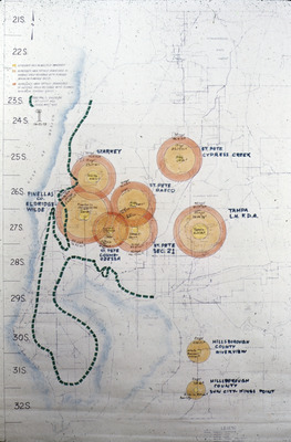
A map showing areas of dewatering in West-Central Florida.
Alt Text
A map with hand-drawn circles and labels marking various locations, overlaid on a geographical grid. The circles are color-coded and contain written notes.
Keywords
Dewatering
Extent
1 map
Physical Collection
Language
English
Media Type
Maps
Identifier
G16-00064
Recommended Citation
Parker, Garald Gordon, "Map, Well Fields Area Circles of Dewater" (1973). Dr. Garald Gordon Parker Collection - Images. Image 26.
https://digitalcommons.usf.edu/parker_photographs/26
Keywords
Dewatering
Rights Statement

