
Binder 18: Photographs and Images
Files
Download
Download Full Text (6.4 MB)
Preview
Creation Date
1980
Abstract
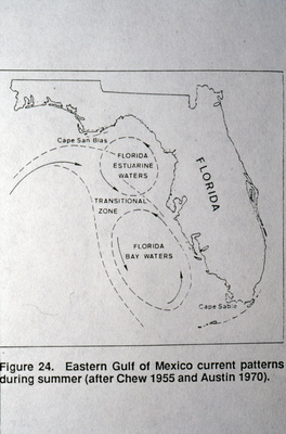
A photograph of a map of the Eastern Gulf of Mexico and the circulation patterns.
Alt Text
A map of Florida's coastline showing current patterns in the Eastern Gulf of Mexico during summer. The map highlights regions like "Florida Estuarine Waters" and "Florida Bay Waters."
Keywords
Maps, Ocean currents
Extent
1 color photograph
Physical Collection
Box
6
Folder
Binder 18
Digital Date
2024
Media Type
Color photographs
Identifier
O19-02553
Recommended Citation
Ogden, John C., "Map of Circulation in the Florida West Coast, Eastern Gulf of Mexico" (1980). Binder 18: Photographs and Images. Image 119.
https://digitalcommons.usf.edu/ogden18_images/119
Keywords
Maps, Ocean currents
Rights Statement

