

Files
Download
Download Full Text (10.1 MB)
Preview
Creation Date
1-23-1986
Abstract
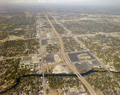
An aerial view of Tampa looking north past the intersection of Interstate Highway 275 and Bird Street.
Alt Text
Aerial view of a city with roads, buildings, and green areas. A river runs through the landscape near the center.
Keywords
Interstate Highway System, Roads
Extent
1 color aerial photograph
Subject: geographic
Hillsborough County (Fla.); Tampa (Fla.)
Physical Collection
Box
28
Digital Date
2024
Media Type
Aerial photographs
Feedback
Identifier
Gandy 28_0066
Recommended Citation
Gandy, George Skip IV, "Interstate Highway 275 and Bird Street, C" (1986). Gandy Photographs - Aerials. Image 892.
https://digitalcommons.usf.edu/gandy_aerials/892
Keywords
Interstate Highway System, Roads
