
Tampa Bay Area Map Collection
Alternative Title
Official Map of the City of Tampa, Florida, and Vicinity
Files
Preview
Publisher
MacDonald Printing Co.
Creation Date
1961
Abstract
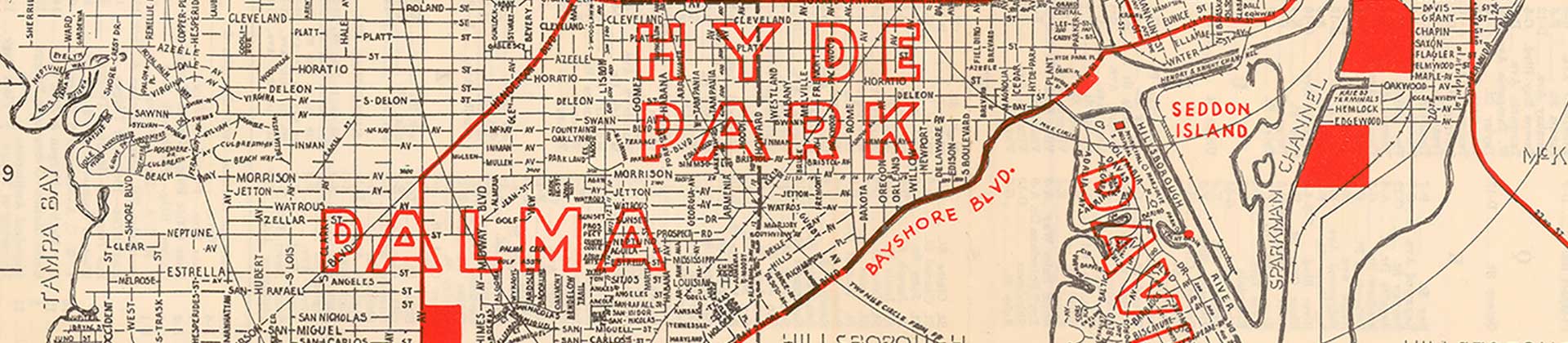
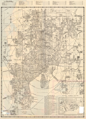
A folded map of public buildings and points of interest in Tampa and St. Petersburg, Florida. On the reverse is a larger map listing the points of interest for St. Petersburg, Clearwater, Tarpon Springs, New Port Richey, and Sarasota, Florida.
Alt Text
Street map of Downtown Tampa with concentric circles showing distance from the county courthouse. An inset map is shown with detailed information for the downtown area
Keywords
Public buildings, Streets, Locations, Highways
Extent
2 maps of 1 page each
Subject: geographic
Hillsborough County (Fla.); Pinellas County (Fla.); Tampa (Fla.); St. Petersburg (Fla.); Clearwater (Fla.); Tarpon Springs (Fla.); New Port Richey (Fla.); Sarasota (Fla.)
Physical Collection
General Map Collection
Language
English
Media Type
City maps
Identifier
U15-1006
Recommended Citation
MacDonald Printing Co., "Greater Tampa, Florida, 1961" (1961). Tampa Bay Area Map Collection. Image 6.
https://digitalcommons.usf.edu/fl_maps_local/6
Rights Statement

