
Tampa Bay Area Map Collection
Alternative Title
North Tampa
Files
Preview
Creation Date
1978
Abstract
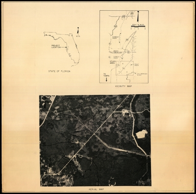
Several aerial maps of North Tampa and a chart of water level indicators by elevation.
Alt Text
Singe image showing three graphics; an aerial image of Tampa Palms in Tampa, an inset map showing its location within Florida, and a vicinity map showing a street map of North Tampa.
Keywords
Aerial photogrammetry, Land use, City planning, Water levels, Elevations
Extent
4 maps of 1 page each; 1 page
Subject: geographic
Hillsborough County (Fla.); Pasco County (Fla.); Cypress Creek (Fla.)
Physical Collection
General Map Collection
Language
English
Media Type
Land use maps
Note
Scale: 11975 [Scale 1:11,975. 1 in. = 1000 ft.]
Identifier
H61-00001
Recommended Citation
DuBois, Susan, "Preliminary Level III Map for Cypress Creek, 1978" (1978). Tampa Bay Area Map Collection. Image 3.
https://digitalcommons.usf.edu/fl_maps_local/3
Keywords
Aerial photogrammetry, Land use, City planning, Water levels, Elevations
Rights Statement

