
Tampa Bay Area Map Collection
Alternative Title
Davis Islands, Tampa in the Bay
Files
Preview

Publisher
Florida Grower Press
Creation Date
1927
Abstract
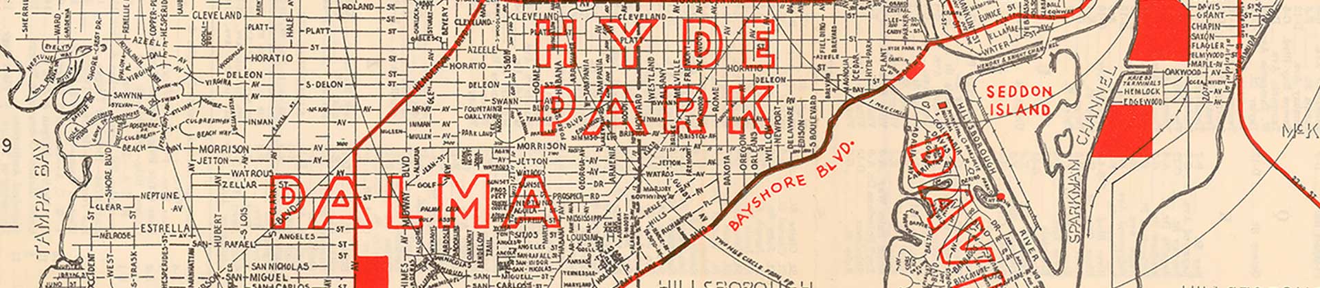
A folded plat map of Davis Islands in Tampa, Florida, circa 1927. On the reverse side are images and facts about Davis Islands.
Alt Text
Color map of Davis Islands showing individual parcels.
Keywords
Housing, Real estate
Scale
[1:4600]
Extent
1 map; 1 page of H 55.7 cm by W 86.0 cm
Subject: geographic
Hillsborough County (Fla.); Tampa (Fla.); Davis Islands (Tampa, Fla.)
Physical Collection
General Map Collection
Call Number
Language
English
Digital Date
2025
Media Type
Plat maps
Note
Art and Engraving by Tampa Photo Engraving Co.
Recommended Citation
Young, G. F., "Map, Davis Islands, Tampa, Florida, 1927, Color" (1927). Tampa Bay Area Map Collection. Image 21.
https://digitalcommons.usf.edu/fl_maps_local/21
Keywords
Housing, Real estate
Image Location
Latitude
27.9145094
Longitude
-82.4563199
Rights Statement

