
Early Printed Map Collection
Files
Download
Download Full Text (2.1 MB)
Preview
Publisher
Thomas & Andrews
Creation Date
January 1796
Abstract
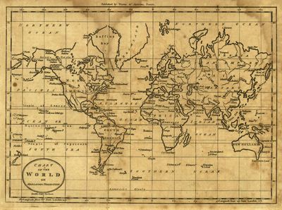
A map of the world using the Mercators projection from 1796.
Alt Text
World map depicted in the Mercator projection. Land shown stretches from 80 degrees North to 60 South.
Keywords
Universal transverse Mercator projection (Cartography)
Extent
1 map
Physical Collection
Rare Map Collection
Language
English
Media Type
Maps
Identifier
U16-0104
Recommended Citation
Doolittle, Amos, "Map, Chart of the World on Mercators Projection, 1796" (1796). Early Printed Map Collection. Image 18.
https://digitalcommons.usf.edu/fl_maps_early/18
Keywords
Universal transverse Mercator projection (Cartography)
Rights Statement

