
Early Printed Map Collection
Files
Download
Download Full Text (2.1 MB)
Preview
Publisher
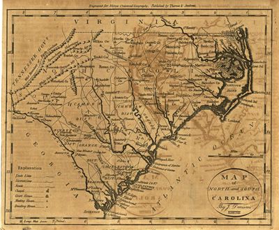
Thomas & Andrews
Creation Date
January 1787
Abstract
A map of North and South Carolina originally published in Jedidiah Morse's Morse's Universal Geography.
Alt Text
Map of North and South Carolina showing roads, churches, court houses, chapels, and dwellings.
Extent
1 map
Subject: geographic
North Carolina; South Carolina
Physical Collection
Rare Map Collection
Language
English
Media Type
Maps
Identifier
U16-0103
Recommended Citation
Denison, J., "Map, Map of North and South Carolina, 1787" (1787). Early Printed Map Collection. Image 17.
https://digitalcommons.usf.edu/fl_maps_early/17
Rights Statement

