
Early Printed Map Collection
Alternative Title
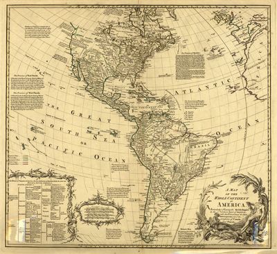
Map, Map of the Whole Continent of America: Particularly Shewing [sic] the British Empire in the Northern Part of America, with the Divisions of the New Governments since the Accession of Canada and Florida, 1780
Files
Download Full Text (11.6 MB)
Preview
Publisher
John & Carington Bowles
Creation Date
January 1780
Abstract
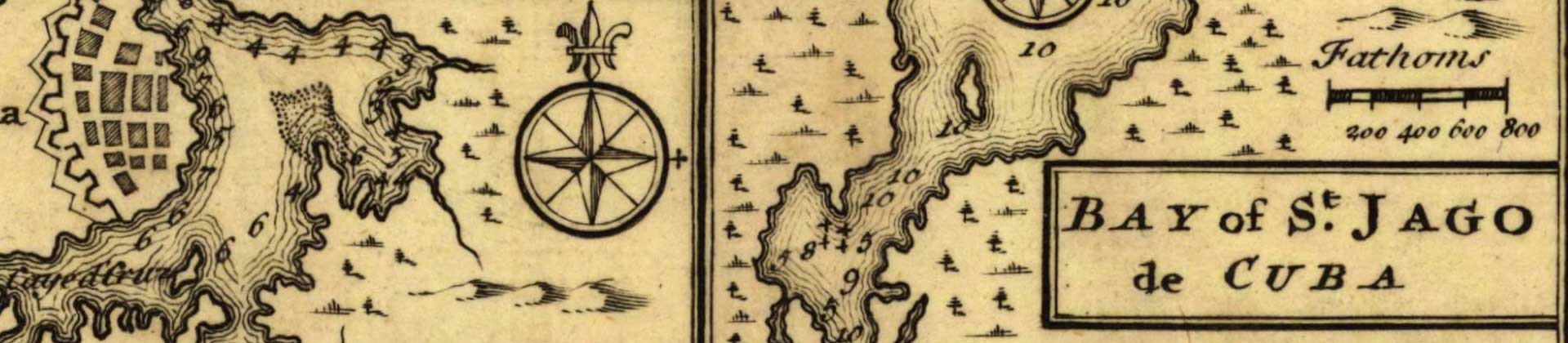
A map of North and South America, showing the boundaries of colonial territories, cities, settlements, bodies of water, and Indigenous land. There are several annotations and descriptive text sections that add notes on the land, Indigenous peoples, discoveries, and the history of colonial claims. A small note next to California explains why many cartographers depicted it as an island. A table in the bottom left further divides North and South America into its colonial possessors.
Alt Text
A map of North and South America, showing the boundaries of colonial territories, cities, settlements, bodies of water, and Indigenous land.
Extent
1 map
Subject: geographic
America
Physical Collection
Rare Map Collection
Call Number
Language
English
Media Type
Maps
Identifier
U16-0076
Recommended Citation
Bowles, John, "Map, Map of the Whole Continent of America, 1780" (1780). Early Printed Map Collection. Image 10.
https://digitalcommons.usf.edu/fl_maps_early/10
Rights Statement

