

Florida Maps Collection
Alternative Title
Map, Map of the Coast of French Florida
Files
Download
Download Full Text (1.0 MB)
Preview
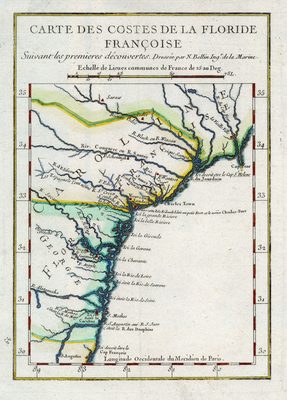
Creation Date
1744
Abstract
A map of the coastal regions of "French Florida," extending from Cape Fear and the Cape Fear River to St. Augustine.
Alt Text
A map of the coastal regions of "French Florida," extending from Cape Fear and the Cape Fear River to St. Augustine.
Scale
4000000, Scale [ca. 1:4,000,000].
Extent
1 map
Subject: geographic
France; North Carolina; South Carolina; Georgia
Language
French
Media Type
Map
Identifier
U15-9044
Recommended Citation
Bellin, Jacques Nicolas, "Map, Carte des Costes de la Floride Françoise, 1744" (1744). Florida Maps Collection. Image 93.
https://digitalcommons.usf.edu/fl_maps_collection/93
Rights Statement

