

Florida Maps Collection
Files
Download
Download Full Text (1.2 MB)
Preview
Publisher
William Stork
Creation Date
1764
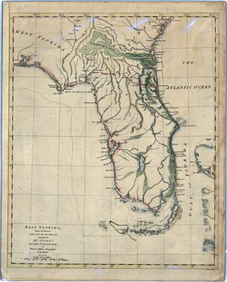
Abstract
A map of Florida showing main cities, inland waters, etc., mainly from East Florida. Relief shown pictorially. Prime meridians are London and Ferro.
Alt Text
Map of Florida showing rivers and ridges. The northern part of Florida shows additional information on vegetation.
Scale
2300000, Scale [ca. 1:2,300,000].
Extent
1 map
Physical Collection
Rare Map Collection
Call Number
Language
English
Media Type
Map
Identifier
U15-0025
Recommended Citation
Jefferys, Thomas, "Map, East Florida from Surveys Made Since the Last Peace, 1764" (1764). Florida Maps Collection. Image 49.
https://digitalcommons.usf.edu/fl_maps_collection/49
Rights Statement

