

Florida Maps Collection
Files
Download
Download Full Text (1.7 MB)
Preview
Publisher
George F. Cram Company
Creation Date
1902
Abstract
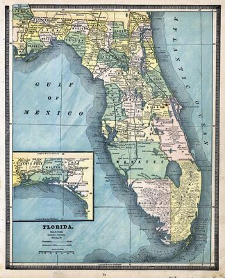
A map of Florida showing the counties, cities and towns, inland waters, railroads and roads. There is an inset map of western portion of the Panhandle.
Alt Text
Map of Florida with counties shown in varying colors. An inset map shows the panhandle of Florida.
Scale
2200000, Scale [ca. 1:2,220,000].
Extent
1 map
Language
English
Media Type
Map
Identifier
U15-0085
Recommended Citation
George F. Cram Company, "Map, Florida, 1902" (1902). Florida Maps Collection. Image 18.
https://digitalcommons.usf.edu/fl_maps_collection/18
Rights Statement

