
Cape Canaveral - 3D Models
Browse the 3D Collections for the Cape Canaveral Space History Collection below.
-

Quarterman North Cemetery
Center for Digital Heritage and Geospatial Information
Two cemeteries are part of the Quarterman settlement that is today located on Cape Canaveral Space Force Station properties and managed by the 45th Space Wing. The Quarterman family were early pioneering families on Cape Canaveral. Starting with William G. M. and Mary A., the family has a rich history with the lighthouse and House of Refuge stations that were operated by the United States Life Saving Service along the coast of Florida, rescuing and sheltering ship-wrecked sailors. The cemeteries are thought to have begun in 1869, and were located in proximity to historic homestead locations on the east edge of the Quarterman Cove area.
-

Quarterman South Cemetery
Center for Digital Heritage and Geospatial Information
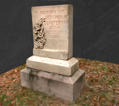
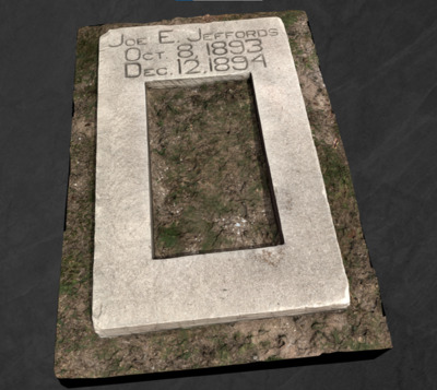
There are three historic 19th Century graves in this family settlement cemetery, located on what is today Cape Canaveral Space Force Station, Florida. All graves are found aligned east/west, and were confirmed as part of our geophysical survey, which included terrestrial laser scanning of the site. The three burials identified by markers include that of George W. G. M. Quarterman and his wife Mary A. Quarterman, along with their three-month old grandchild, Verginia W. Quarterman. Mary and Verginia have original grave markers, while George’s grave is marked with a headstone that was placed sometime between 1994 and 2006 atop a cement marker.
-

Quarterman South Gravestones
Center for Digital Heritage and Geospatial Information
A small family cemetery that is located today at Cape Canaveral Space Force Station.
-

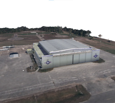
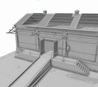
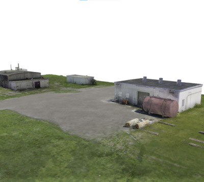
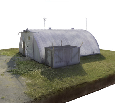
Quonset Hut - Museum and Paint Storage
Center for Digital Heritage and Geospatial Information
Facility 41303 is a metal Quonset hut that was built in 1960 to serve as office space and a shop during the human crewed Project Mercury missions, the United States’ first man-in-space program. Throughout its tenure, the structure served as office, shop, and storage, most recently for the Space Force Museum’s collection of items from the Cape Canaveral Lighthouse. Adjacent to the Quonset hut is a small, steel plated storage structure identified as a Paint and Oil Locker, Facility 41307. This building dates to 1995 and is not historic.
-

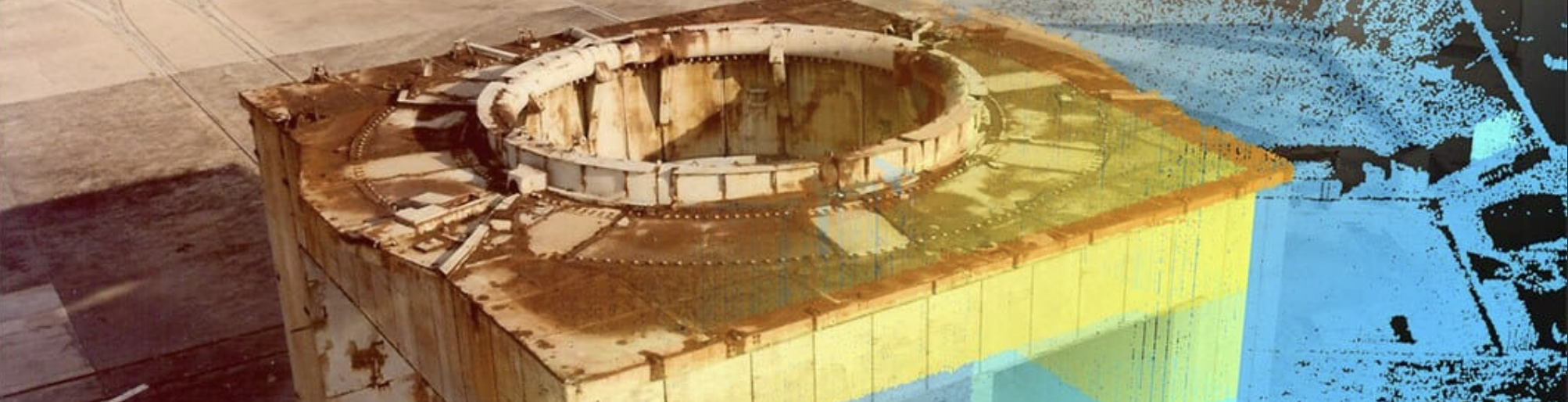
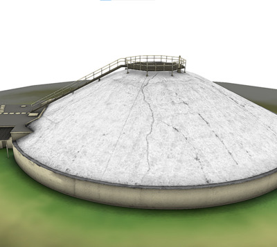
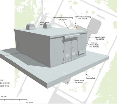
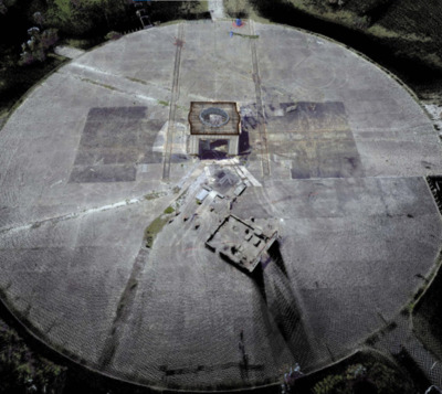
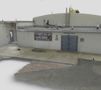
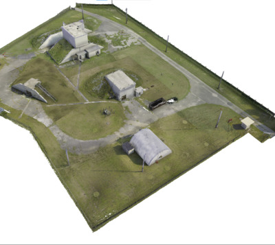
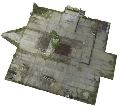
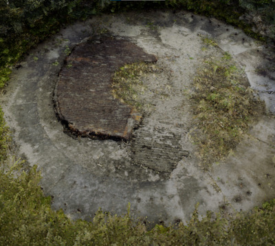
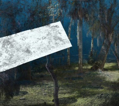
Ramp and Stand at Launch Complex 20
Center for Digital Heritage and Geospatial Information
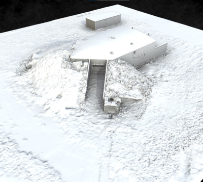
Facility 15500B-Launch Stand and Ramp (8BR3154) - Point cloud from terrestrial laser scanning survey of the ramp area at Launch Complex 20. The Launch Stand and Ramp were constructed specifically for the Titan-I program between 1957 and 1959. The site is no longer extant in 2023.
-

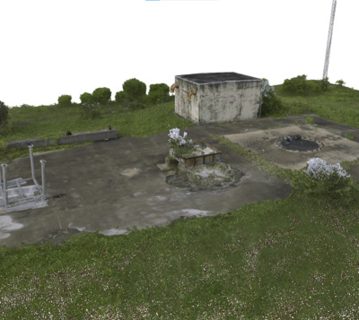
Searchlight Depot Facility 7800
Center for Digital Heritage and Geospatial Information
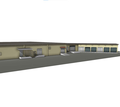
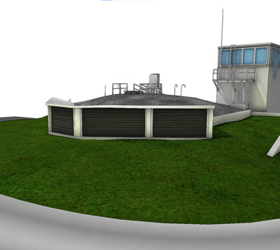
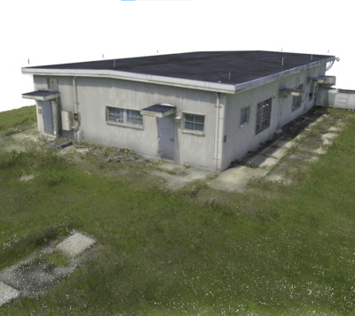
Part of the Hangar C campus, this cement block structure was built in 1957 and functioned as a warehouse supply and equipment base.
-

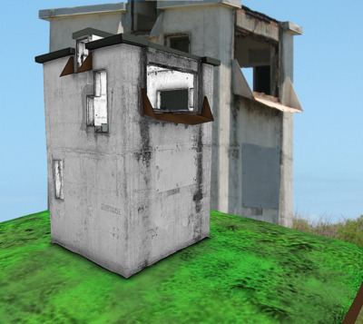
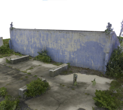
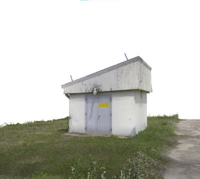
Sentry House
Center for Digital Heritage and Geospatial Information
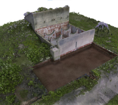
The Sentry House, Facility 40135, is not the original guard building at the LC 5-6 Spin Test Facility at Cape Canaveral Space Force Station. It was added when the U.S. Navy used the complex as a storage facility and is considered not historically contributing to the site and is less than 50 years old. The small wood structure is anchored on a poured concrete slab adjacent to the of the site’s east access road and gate.
-

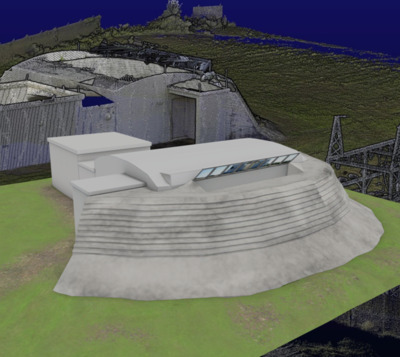
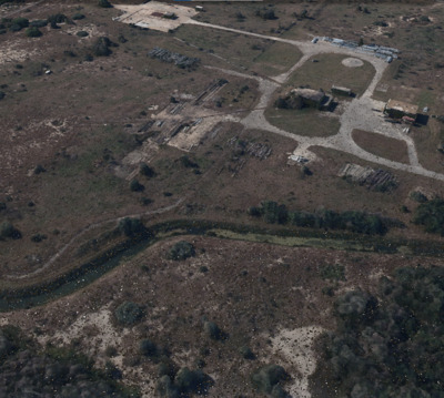
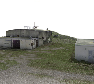
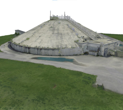
Spin Test Building
Center for Digital Heritage and Geospatial Information
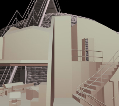
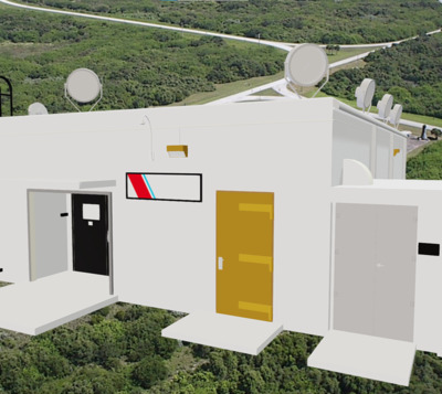
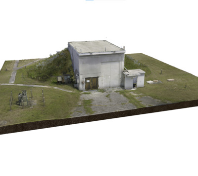
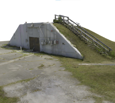
8BR3053 (aka Facility 1221), is the Spin Test Building that is part of the LC5-6 Spin Test Facility at Cape Canaveral Space Force Station. The structure has gone through several name changes and missions over the years since its construction, originally built in 1956 as the Spin Test Building. The primary entrance was through a pair of tall metal doors on the structure’s northwest side that allowed for the ingress and egress of missile motors, parts, and satellites for spin testing. On the southeast side an opening 10 feet from the ground surface at the center of the building, allowed observation of the interior from mirrors mounted in an Observation Pit. The facility continued as a spin test and research testing structure for NASA’s Lunar Orbiter program until the program ended in 1968, and the site then reverted to the Air Force and was used as an artifact storage facility for the Air Force Space and Missile Museum.
-

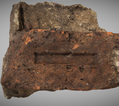
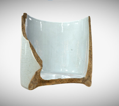
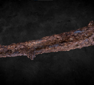
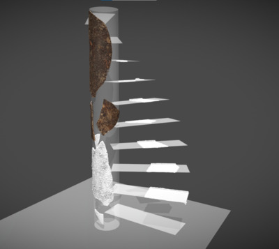
Stone Plummet
Center for Digital Heritage and Geospatial Information
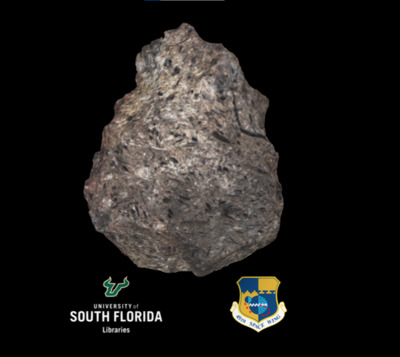
Artifact recovered from the USF Cape Canaveral Air Force Station Cultural Resource survey of land management units. This piece was laser scanned using a structured light instrument.
-

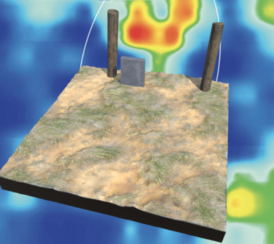
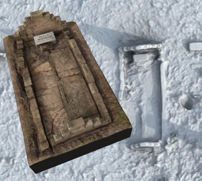
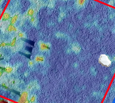
The Penny Historic Cemetery
Center for Digital Heritage and Geospatial Information
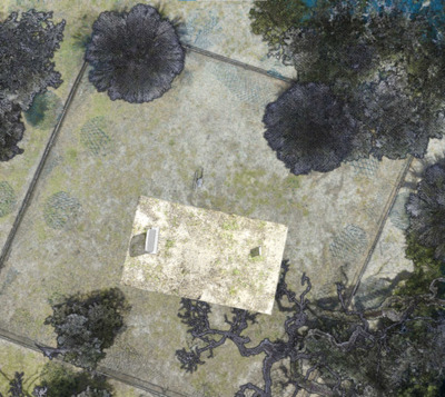
The Penny Cemetery (8BR2354) site is located today on the Cape Canaveral Space Force Station. Our survey included subsurface remote sensing with ground penetrating radar (GPR), performed along with GPS and terrestrial laser scanning and mapping. Results suggest one burial, with the anomaly likely attributed to the historic monument location for Maria Penny, although there is the possibility for an intrusive burial relating to her husband, Nathan N., which may be overlapping with Maria’s grave. Follow-up from field verification work is needed to confirm. The Penny’s had a homestead on the Banana River off the Canaveral Peninsula in the vicinity of this burial plot. The homestead included an orange grove. Nathan served as Postmaster for the settlement that bore his name.
-

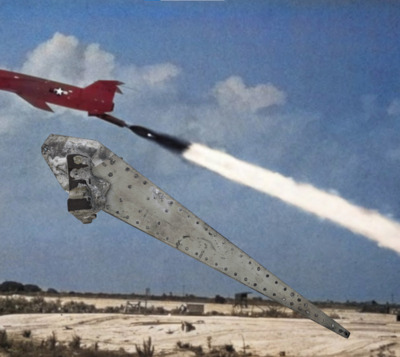
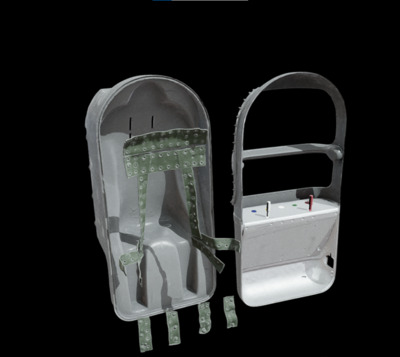
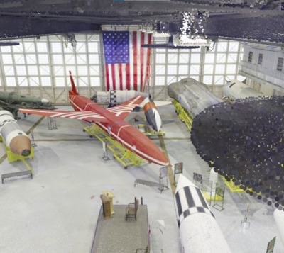
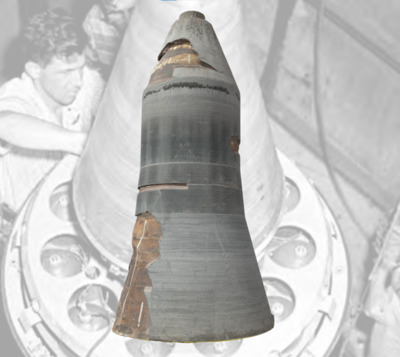
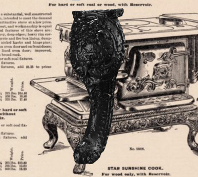
Thermonuclear Warhead GE AVCO Mark 5 Test
Center for Digital Heritage and Geospatial Information
Photogrammetry (color removed ) model from our digital program with the Space Launch Delta 45 Program. The Mark 5 Reentry vehicle was used on the LGM-30 Minuteman I & II ICBMs to protect its warhead as it reentered the atmosphere. The steel honeycomb structure has a quartz resin coating that burns away during reentry to dissipate the heat. Inside the reentry vehicle is a Type W59 thermonuclear warhead with a yield equivalent to one million tons of TNT. Test launches of Minuteman I missiles began in February 1961 at LC-31 on the Cape Canaveral Space Force Station. The first operational missiles came into service in October 1962. This Mark 5 was launched from Vandenberg AFB, California, in the early 1960’s as part of a test exercise. The piece was recovered from the target site at Eniwetok Atoll and given to the Air Force Space and Missile Museum in 1965 and is today on display at Cape Canaveral Space Force Station.
-

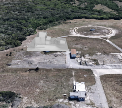
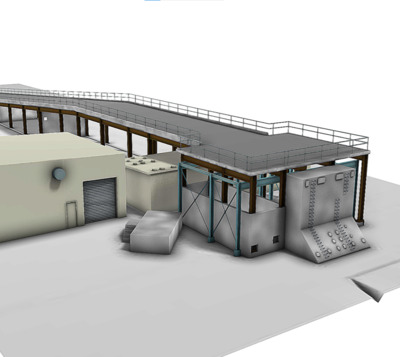
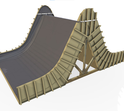
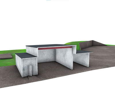
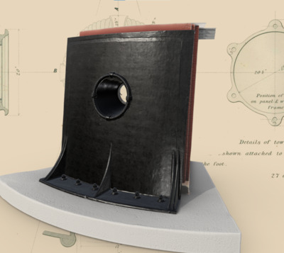
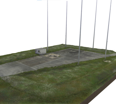
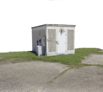
Wave Guide Access Structure
Center for Digital Heritage and Geospatial Information
Facility 56608 was the Wave Guide Access Structure for a portable radar unit from the now demolished Area 55 facility at Cape Canaveral Space Force Station. The poured concrete ramp and stand had a T-shaped opening and connections for securing antenna were evident. Ideal CAD model.
-

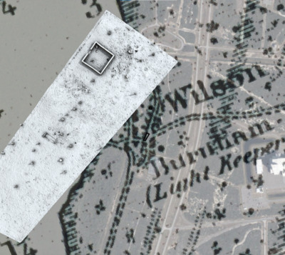
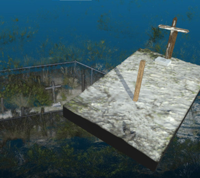
Wilson Brothers Cemetery 3D Terrain
Center for Digital Heritage and Geospatial Information
This historic cemetery located on Cape Canaveral Space Force Station, has two marked burials for the brothers Alfred B. Wilson and Frank M. Wilson. These 20th Century burials are each marked with marble headstones, and in the southwest corner there is a memorial plaque. The plaque, placed on the site in the 1960s, reads: THIS GRAVESITE OF A FELLOW/CHIEF PETTY OFFICER/IS MAINTAINED BY THE/CHIEF PETTY OFFICERS/ASSOCIATION/NAVAL ORDINANCE TEST UNIT.
