
Audubon’s Everglades Science Center - Photographs
Files
Download
Download Full Text (1.3 MB)
Preview
Creation Date
1934
Time Period
circa 1934
Abstract
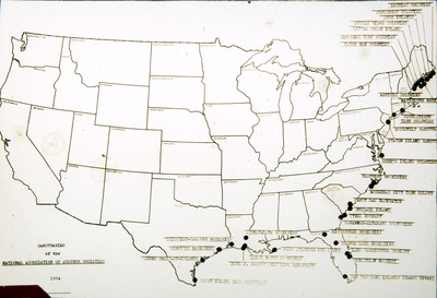
A map of Audubon sanctuaries circa 1934.
Alt Text
A map of the United States with black dots marking various locations along the East Coast and some other regions. The map includes labels and annotations, likely indicating specific points of interest or data points.
Keywords
National Audubon Society, Bird sanctuaries
Extent
1 glass lantern slide
Physical Collection
Box
238
Folder
5
Language
English
Media Type
Lantern slides
Identifier
A64-01058
Recommended Citation
Audubon Florida, "Map, Audubon Society Sanctuaries" (1934). Audubon’s Everglades Science Center - Photographs. Image 452.
https://digitalcommons.usf.edu/aesc_photographs/452
Keywords
National Audubon Society, Bird sanctuaries
Rights Statement