
Binder 02: Photographs and Images
Files
Download Full Text (5.2 MB)
Preview
Creation Date
1983
Time Period
circa 1983
Abstract
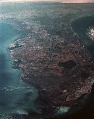
A satellite view of the Florida Peninsula, showing the landmass bordered by the Gulf of Mexico and the Atlantic Ocean. Coastal regions and inland bodies of water are clearly visible across the landscape.
Alt Text
Satellite image of a peninsular land mass surrounded by blue ocean water. The aerial viewpoint allows for views of the varying elevations on the landmass, as well as many of its urban and natural areas.
Keywords
Marine science, Oceanography, Weather, Clouds, Satellite imagery
Extent
1 color photograph
Physical Collection
Box
1
Folder
Binder 2
Digital Date
2024
Media Type
Color Photographs
Identifier
O19-02127
Recommended Citation
Ogden, John C., "Satellite View of the Florida Peninsula" (1983). Binder 02: Photographs and Images. Image 94.
https://digitalcommons.usf.edu/ogden2_images/94
Keywords
Marine science, Oceanography, Weather, Clouds, Satellite imagery
Rights Statement

