
Binder 18: Photographs and Images
Files
Download
Download Full Text (3.6 MB)
Preview
Creation Date
1980
Abstract
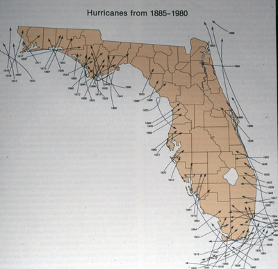
A photograph of a map recording the hurricanes that entered Florida.
Alt Text
A map of Florida showing the paths of hurricanes from 1885 to 1980, with lines and dates marked across the state where the storm made landfall. The map highlights various regions affected by these hurricanes over the years.
Keywords
Maps, Meteorology, Weather
Extent
1 color photograph
Physical Collection
Box
6
Folder
Binder 18
Digital Date
2024
Media Type
Color photographs
Identifier
O19-02559
Recommended Citation
Ogden, John C., "Map of Hurricanes Entries into Florida, 1885-1980" (1980). Binder 18: Photographs and Images. Image 125.
https://digitalcommons.usf.edu/ogden18_images/125
Keywords
Maps, Meteorology, Weather
Rights Statement

