
Audubon Society Okeechobee-Kissimmee and Chandler Warden - Records
Files
Download
Download Full Text (10.6 MB)
Publication Date
2-6-1998
Abstract
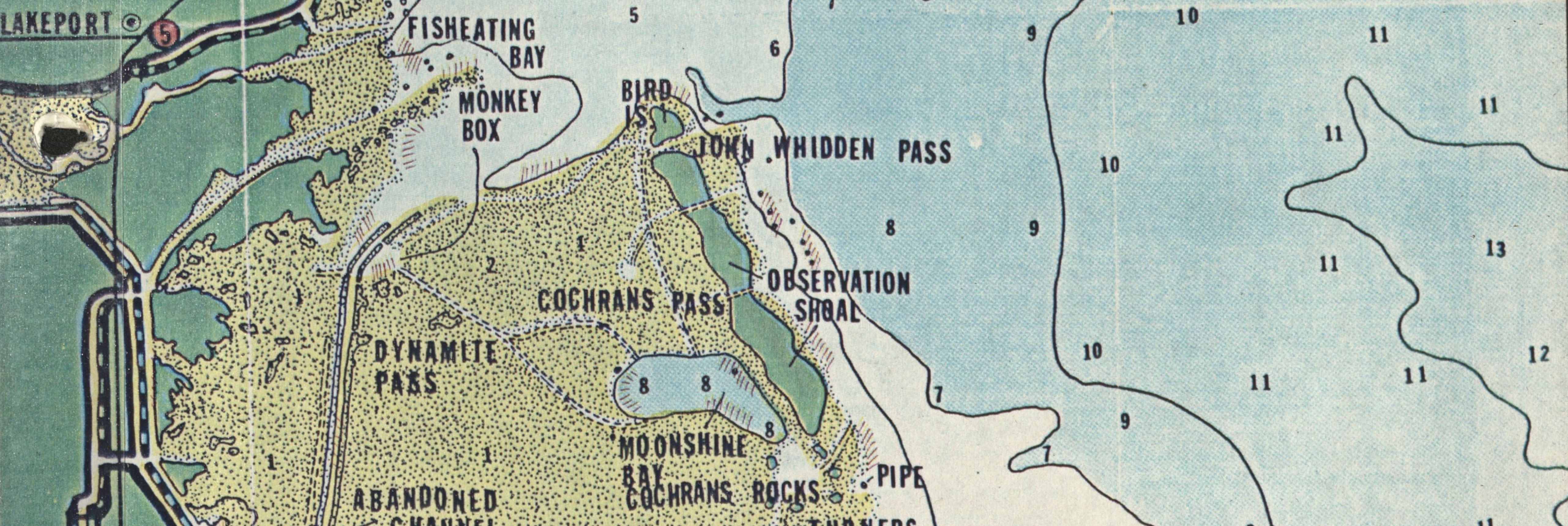
Platt book map of Okeechobee county, showing the 101 Ranch's boundaries; a false-color infrared map of 101 Ranch's shell mining location; and a permit for modifications to re-establish 101 Ranch's boundaries.
Keywords
National Audubon Society, Law and legislation, Boundaries
Extent
16 pages
Geographic Location
Okeechobee (Fla.); Kissimmee Prairie Preserve (Fla.)
Physical Collection
National Audubon Society Okeechobee/Kissimmee and Chandler Warden Records
Box
2
Folder
9
Language
English
Media Type
Maps; Permits
Type
Text
Identifier
L41-00070
Recommended Citation
Gray, Paul N., "Maps and Permit, 101 Ranch, February 6, 1998" (1998). Audubon Society Okeechobee-Kissimmee and Chandler Warden - Records. 55.
https://digitalcommons.usf.edu/lorida_records/55
Book Location
Latitude
27.5698794
Longitude
-81.085812
Rights Statement

