

Gandy Photographs - Streets, Buildings, and Construction
Files
Download Full Text (6.5 MB)
Preview
Creation Date
1970
Time Period
circa 1970s
Abstract
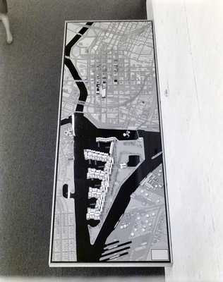
Scale architectural model of Port Tampa and downtown. Taken as part of Horizon 2000, a project adopted by local government to address concerns of growth management by the year 2000.
Alt Text
A rectangular framed map showing a detailed layout of buildings and roads. The map is placed on a surface with a carpet background.
Keywords
Architectural models, Central business districts, City planning
Extent
1 black-and-white photograph
Subject: geographic
Hillsborough County (Fla.); Tampa (Fla.)
Physical Collection
Box
26
Digital Date
2024
Media Type
Black-and-white photographs
Feedback
Identifier
Gandy 26_1283
Creative Commons

This work is licensed under a Creative Commons Attribution 3.0 License.
Recommended Citation
Gandy, George Skip IV, "Model Map of Port Tampa and Downtown, F" (1970). Gandy Photographs - Streets, Buildings, and Construction. Image 5821.
https://digitalcommons.usf.edu/gandy_street/5821
Keywords
Architectural models, Central business districts, City planning
