

Files
Download
Download Full Text (9.6 MB)
Preview
Creation Date
5-4-1999
Abstract
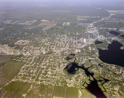
An aerial view of U.S. Highway 41 at the intersection with State Road 44, looking southwest.
Alt Text
Aerial view of a city with surrounding green areas and water bodies, showing urban development and infrastructure. The landscape includes roads, buildings, and patches of vegetation.
Keywords
Interstate Highway System, Roads
Extent
1 color aerial photograph
Subject: geographic
Citrus County (Fla.); Inverness (Fla.)
Physical Collection
Box
28
Digital Date
2024
Media Type
Aerial photographs
Feedback
Identifier
Gandy 28_0136
Recommended Citation
Gandy, George Skip IV, "U.S. Highway 41 South, G" (1999). Gandy Photographs - Aerials. Image 962.
https://digitalcommons.usf.edu/gandy_aerials/962
Keywords
Interstate Highway System, Roads
