

Files
Download
Download Full Text (9.2 MB)
Preview
Creation Date
5-4-1999
Abstract
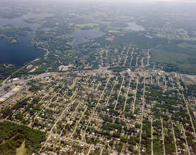
An aerial view of U.S. Highway 41, east of the intersection with State Road 44, looking east towards Henderson Lake.
Alt Text
Aerial view of a suburban area with a grid-like street layout, surrounded by bodies of water and greenery. The image shows houses, roads, and various infrastructure from above.
Keywords
Interstate Highway System, Roads
Extent
1 color aerial photograph
Subject: geographic
Citrus County (Fla.); Inverness (Fla.)
Physical Collection
Box
28
Digital Date
2024
Media Type
Aerial photographs
Feedback
Identifier
Gandy 28_0105
Recommended Citation
Gandy, George Skip IV, "U.S. Highway 41 South, A" (1999). Gandy Photographs - Aerials. Image 931.
https://digitalcommons.usf.edu/gandy_aerials/931
Keywords
Interstate Highway System, Roads
