

Files
Download
Download Full Text (11.1 MB)
Preview
Creation Date
3-22-1985
Abstract
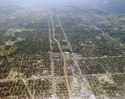
An aerial view of Tampa looking south past the intersection of Interstate Highway 275 and Busch Boulevard and the Hillsborough River, towards Hillsborough Bay.
Alt Text
Aerial view of a city with a grid-like street layout, featuring buildings, roads, and green spaces. The city extends towards a distant horizon with varying land use patterns.
Keywords
Interstate Highway System, Roads
Extent
1 color aerial photograph
Subject: geographic
Hillsborough County (Fla.); Tampa (Fla.)
Physical Collection
Box
28
Digital Date
2024
Media Type
Aerial photographs
Feedback
Identifier
Gandy 28_0052
Recommended Citation
Gandy, George Skip IV, "Interstate Highway 275 and Busch Boulevard, B" (1985). Gandy Photographs - Aerials. Image 878.
https://digitalcommons.usf.edu/gandy_aerials/878
Keywords
Interstate Highway System, Roads
