

Files
Download
Download Full Text (10.5 MB)
Preview
Creation Date
12-14-1982
Abstract
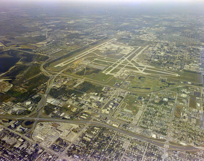
An aerial photograph depicting Tampa International Airport and Interstate Highway 275. The sprawling landscape of Tampa is visible beyond the airport.
Alt Text
Aerial view of an airport with runways and surrounding urban area, including roads and buildings. The landscape extends to distant neighborhoods and greenery.
Keywords
Interstate Highway System, TPA, Airports
Extent
1 color aerial photograph
Subject: geographic
Hillsborough County (Fla.); Tampa (Fla.)
Physical Collection
Box
28
Digital Date
2024
Media Type
Aerial photographs
Feedback
Identifier
Gandy 28_0015
Recommended Citation
Gandy, George Skip IV, "Aerial View of Interstate Highway 275 and Tampa International Airport" (1982). Gandy Photographs - Aerials. Image 841.
https://digitalcommons.usf.edu/gandy_aerials/841
Keywords
Interstate Highway System, TPA, Airports
