

Files
Download
Download Full Text (11.1 MB)
Preview
Creation Date
3-22-1985
Abstract
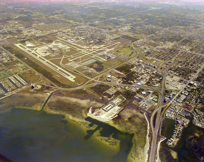
An aerial photograph depicting Tampa International Airport and Interstate Highway 275.
Alt Text
Aerial view of an airport surrounded by urban and suburban areas, with a body of water nearby. The landscape includes roads, buildings, and green spaces.
Keywords
Interstate Highway System, TPA, Airports
Extent
1 color aerial photograph
Subject: geographic
Hillsborough County (Fla.); Tampa (Fla.)
Physical Collection
Box
28
Digital Date
2024
Media Type
Aerial photographs
Feedback
Identifier
Gandy 28_0006
Recommended Citation
Gandy, George Skip IV, "Aerial View of Interstate Highway 275 and Tampa International Airport" (1985). Gandy Photographs - Aerials. Image 832.
https://digitalcommons.usf.edu/gandy_aerials/832
Keywords
Interstate Highway System, TPA, Airports
