

Files
Download
Download Full Text (11.3 MB)
Preview
Creation Date
11-1-1982
Abstract
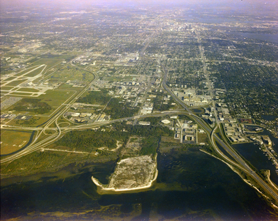
An aerial photograph depicting the intersection of the city of Tampa with the I-275 Howard Frankland Bridge, revealing a portion of Tampa International Airport on the lefthand side.
Alt Text
Aerial view of a city with roads, buildings, and green areas surrounding a body of water. In the foreground, there's an island with sandy terrain.
Keywords
Interstate Highway System, TPA
Extent
1 color aerial photograph
Subject: geographic
Hillsborough County (Fla.); Tampa (Fla.); Tampa Bay (Fla.)
Physical Collection
Box
28
Digital Date
2024
Media Type
Aerial photographs
Feedback
Identifier
Gandy 28_0003
Recommended Citation
Gandy, George Skip IV, "Aerial View of Interstate Highway 275, Tampa International Airport, and Tampa Bay, C" (1982). Gandy Photographs - Aerials. Image 829.
https://digitalcommons.usf.edu/gandy_aerials/829
Keywords
Interstate Highway System, TPA
