

Files
Download Full Text (5.9 MB)
Preview
Creation Date
1960
Time Period
circa 1960s-1970s
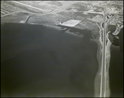
Abstract
Aerial image depicting the Rocky Point area in Tampa Bay, Florida, showcasing the nearby Howard Franklin Bridge and coastal developments, with the shoreline and adjacent land formations visible.
Alt Text
Aerial view of a coastline with a large body of water and adjacent land area featuring roads, buildings, and open spaces. The landscape includes a runway or road extending into the distance.
Keywords
Aerial views, Coastlines, Ocean, Canals
Extent
1 black-and-white photograph
Subject: geographic
Hillsborough County (Fla.); Tampa (Fla.)
Physical Collection
Box
6
Digital Date
2024
Media Type
Black-and-white photographs
Feedback
Click to provide feedback about the metadata for this photograph.
Identifier
Gandy 06_0042
Recommended Citation
Gandy, George Skip IV, "Aerial View of Rocky Point Area" (1960). Gandy Photographs - Aerials. Image 78.
https://digitalcommons.usf.edu/gandy_aerials/78
Keywords
Aerial views, Coastlines, Ocean, Canals
