

Files
Download
Download Full Text (10.0 MB)
Preview
Creation Date
1-14-1990
Abstract
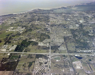
An aerial view of I-75 and Beeridge Road Interchange at Sarasota, featuring a network of roads, numerous buildings and the bay area.
Alt Text
Aerial view of a coastal city with urban and rural areas, featuring roads, buildings, and green spaces. The ocean is visible in the background beyond the land.
Keywords
Interstate 75, Aerial photography, Lakes, Bays
Extent
1 color photograph
Subject: geographic
Sarasota County (Fla.); Sarasota (Fla.)
Physical Collection
Box
27
Digital Date
2024
Media Type
Color photographs
Feedback
Identifier
Gandy 27_1637
Recommended Citation
Gandy, George Skip IV, "I-75 and Beeridge Road Interchange, Sarasota" (1990). Gandy Photographs - Aerials. Image 694.
https://digitalcommons.usf.edu/gandy_aerials/694
Keywords
Interstate 75, Aerial photography, Lakes, Bays
