

Files
Download Full Text (7.8 MB)
Preview
Creation Date
1960
Time Period
circa 1960s-1970s
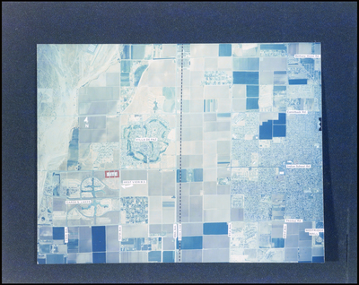
Abstract
Aerial view highlighting the Villa de Paz and Garden Lakes areas in Phoenix, Arizona, with surrounding agricultural fields and urban developments.
Alt Text
An aerial view with blue and white tones showing a landscape divided into various sections. The map features labels and markings indicating different areas and landmarks.
Keywords
Aerial views, Residential development, Grocery stores
Extent
1 color photograph
Subject: geographic
Maricopa County (Ariz.); Phoenix (Ariz.)
Physical Collection
Box
7
Digital Date
2024
Media Type
Color photographs
Feedback
Click to provide feedback about the metadata for this photograph.
Identifier
Gandy 07_0395_undetermined
Recommended Citation
Gandy, George Skip IV, "Aerial View of Villa de Paz and Garden Lakes" (1960). Gandy Photographs - Aerials. Image 36.
https://digitalcommons.usf.edu/gandy_aerials/36
Keywords
Aerial views, Residential development, Grocery stores
