

Files
Download Full Text (6.5 MB)
Preview
Creation Date
1960
Time Period
circa 1960s-1970s
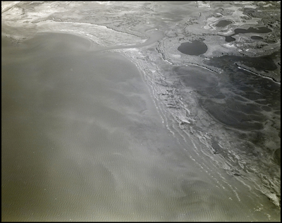
Abstract
Aerial view of the Mariposa Key shoreline in Florida, showcasing the meeting point of land and water. The image captures the intricate patterns of the coastal landscape, including tidal flats, sandbars, and surrounding wetlands.
Alt Text
Aerial view of a coastal area with shallow waters and sandbars, transitioning to darker, deeper water with visible circular formations. The landscape shows a mix of light and dark patches, likely indicating varying water depths and sediment patterns.
Keywords
Aerial views, Coastlines, Ocean
Extent
1 black-and-white photograph
Subject: geographic
Manatee County (Fla.); Mariposa Key (Fla.)
Physical Collection
Box
6
Digital Date
2024
Media Type
Black-and-white photographs
Feedback
Click to provide feedback about the metadata for this photograph.
Identifier
Gandy 06_0084
Recommended Citation
Gandy, George Skip IV, "Aerial View of Coastal Area near Mariposa Key" (1960). Gandy Photographs - Aerials. Image 120.
https://digitalcommons.usf.edu/gandy_aerials/120
Keywords
Aerial views, Coastlines, Ocean
