

Files
Download Full Text (7.5 MB)
Preview
Creation Date
1960
Time Period
circa 1960s-1970s
Abstract
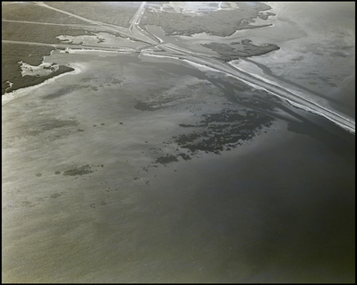
The Howard Frankland Bridge crossing Tampa Bay, connecting the cities of Tampa and St. Petersburg in Florida. Coastal wetlands and waterways surround the bridge area.
Alt Text
Aerial view of a coastal area with water and land features, including patches of ice and snow. The landscape shows a mix of dark and light areas, likely indicating varying water depths and land cover.
Keywords
Aerial views, Coastlines, Ocean, Islands, Bridges
Extent
1 black-and-white photograph
Subject: geographic
Pinellas County (Fla.); St. Petersburg (Fla.)
Physical Collection
Box
6
Digital Date
2024
Media Type
Black-and-white photographs
Feedback
Click to provide feedback about the metadata for this photograph.
Identifier
Gandy 06_0082
Recommended Citation
Gandy, George Skip IV, "Aerial View of the Howard Frankland Bridge Area, A" (1960). Gandy Photographs - Aerials. Image 118.
https://digitalcommons.usf.edu/gandy_aerials/118
Keywords
Aerial views, Coastlines, Ocean, Islands, Bridges
