

Florida Maps Collection
Files
Download
Download Full Text (1.5 MB)
Preview
Publisher
Johannis Bogardi
Creation Date
1597
Abstract
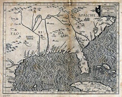
A hand-colored map of Florida and the Southeast coast of North America. The map shows the area extending from Cuba to North Carolina.
Alt Text
Map of Florida and the Southeast coast of North America. The map shows the area extending from Cuba to North Carolina.
Scale
11000000, Scale ca. 1:11,000,000.
Extent
1 map
Subject: geographic
Cuba; Georgia; South Carolina; North Carolina
Physical Collection
Rare Map Collection
Call Number
Language
Latin
Media Type
Map
Identifier
U15-0022
Recommended Citation
Wytfliet, Corneille, "Map, Florida et Apalche, 1597" (1597). Florida Maps Collection. Image 68.
https://digitalcommons.usf.edu/fl_maps_collection/68
Rights Statement

