

Florida Maps Collection
Files
Download
Download Full Text (988 KB)
Preview
Publisher
I.T. Hinton & Simpkin & Marshall
Creation Date
1832
Abstract
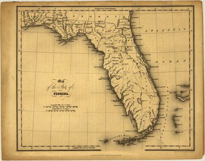
A map of Florida showing counties, towns, and Seminole land.
Alt Text
Map of Florida showing waterways, cities, villages, and trails the panhandle and peninsula.
Scale
4181760, Scale [ca. 1:4,181,760]
Extent
1 map
Physical Collection
Touchton Map Collection
Holding Location
Tampa Bay History Center
Language
English
Media Type
Map
Identifier
U15-0011
Recommended Citation
Hinton, Isaac Taylor, "Map, Florida, History and Topography of the United States, 1832, Black and White" (1832). Florida Maps Collection. Image 30.
https://digitalcommons.usf.edu/fl_maps_collection/30
Rights Statement

