

Florida Maps Collection
Files
Download
Download Full Text (1.5 MB)
Preview
Publisher
George F. Cram Company
Creation Date
1885
Abstract
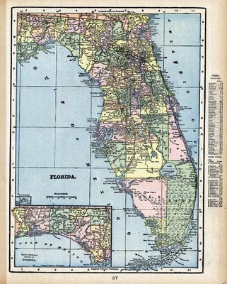
This is a map of Florida showing the counties, cities and towns, inland waters, railroads, etc, circa 1885. There is also an inset map titled "North-Western Portion of Florida."
Alt Text
Map of Florida with counties shown in varying colors. An inset map shows the panhandle of Florida.
Scale
2200000, Scale [ca. 1:2,220,000].
Extent
1 map
Language
English
Media Type
Map
Identifier
U15-0086
Recommended Citation
George F. Cram Company, "Map, Florida, 1885" (1885). Florida Maps Collection. Image 19.
https://digitalcommons.usf.edu/fl_maps_collection/19
Rights Statement

