Florida Maps Collection
Files
Download
Download Full Text (60.0 MB)
Preview
Creation Date
1960
Time Period
circa 1960-1990
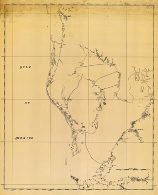
Abstract
A map of Pinellas County, western Hillsborough County, the northwestern edge of Manatee County, Tampa Bay and the Hillsborough Bay, and three bridges.
Alt Text
A simple map of Hillsborough County, Pinellas, County, and Manatee county showing coastline.
Extent
1 map
Subject: geographic
Pinellas County (Fla.); Hillsborough County (Fla.); Manatee County (Fla.);
Language
English
Media Type
Map
Identifier
U15-1010
Recommended Citation
Unknown, "Map, Tampa Bay Region, circa 1960-1990" (1960). Florida Maps Collection. Image 175.
https://digitalcommons.usf.edu/fl_maps_collection/175
Rights Statement