

Florida Maps Collection
Files
Download
Download Full Text (14.5 MB)
Preview
Publisher
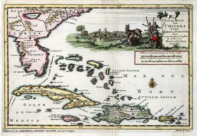
Pieter vander Aa
Creation Date
1706
Time Period
1706
Keywords
Atlantic Coast (South Atlantic States), West Indies, Florida
Subject: geographic
Atlantic Coast (South Atlantic States), West Indies, Florida
Holding Location
University of South Florida Library
Language
Dutch
Format
Map
Identifier
U15-9059
Recommended Citation
van der Aa, Pieter, "De vaste kust van Chicora tussen Florida en Virginie" (1706). Florida Maps Collection. Image 154.
https://digitalcommons.usf.edu/fl_maps_collection/154
Keywords
Atlantic Coast (South Atlantic States), West Indies, Florida
Rights Statement

