

Florida Maps Collection
Alternative Title
Map, Tampa Bay
Files
Download
Download Full Text (8.8 MB)
Preview
Creation Date
1818
Abstract
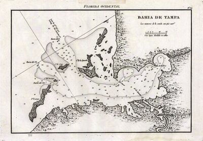
Nautical chart showing the port of Tampa, Florida. Oriented with north toward top right of sheet.
Alt Text
Chart of the Bahia de Tampa showing coastal islands and water depths.
Scale
170000, Scale [ca. 1:170,000].
Extent
1 map
Subject: geographic
Tampa Bay (Fla.)
Physical Collection
Rare Map Collection
Call Number
Language
Spanish
Media Type
Map
Identifier
U15-0111
Recommended Citation
Spain. Dirección de Trabajos Hidrográficos, "Map, Bahía de Tampa, 1818" (1818). Florida Maps Collection. Image 123.
https://digitalcommons.usf.edu/fl_maps_collection/123
Rights Statement

