

Richard A. "Skip" Davis, Jr. Collection of Coastal and Geologic Illustrations
Files
Download
Download Full Text (7.9 MB)
Preview
Creation Date
July 1987
Alt Text
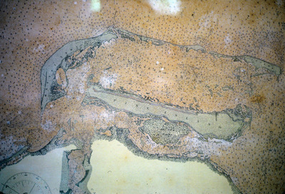
A tan and yellow map with land and water masses marked with dots and labels.
Keywords
Maps, Nautical charts
Extent
1 map
Subject: geographic
Lee County (Fla.); Captiva (Fla.); Sanibel Island (Fla.)
Physical Collection
Language
English
Media Type
Maps
Identifier
D34-00475
Recommended Citation
Davis, Richard A., "Old Map of Sanibel, Captiva Island, Florida" (1987). Richard A. "Skip" Davis, Jr. Collection of Coastal and Geologic Illustrations. Image 692.
https://digitalcommons.usf.edu/davis_coastal/692
Keywords
Maps, Nautical charts
Rights Statement

