
Historic Launch Complexes Photos
Files
Download Full Text (1.6 MB)
Preview

Creation Date
10-20-2020
Abstract
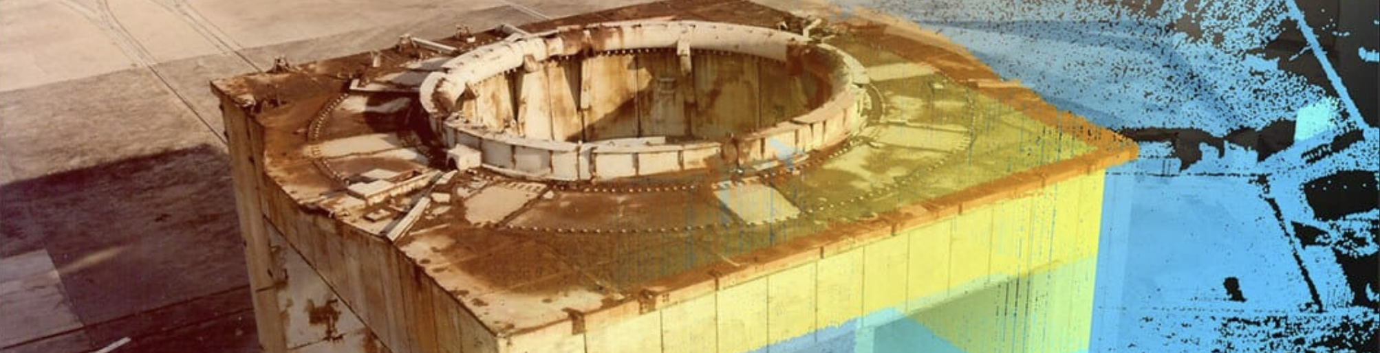
Exterior 3D scanning and imaging documentation of the LC26 Blockhouse. Sponsored by Space Launch Delta 45, Cape Canaveral Space Force Station and Argonne National Laboratory.
Alt Text
A white building with its heavy metal doors standing open while a man on its roof holds an object and stands near a camera on a tripod. Signs around the doorway identify the building as the "blockhouse" and "launch shelter" of "Complex-26, launch site of Explorer-1, America's first satellite."
Keywords
Launch complexes (Astronautics), Canaveral, Cape (Fla. : Cape), Cold War, Space stations, Explorer satellites, Explorer 1 (Artificial satellite)--Orbit
Extent
1 color photograph; DSLR; 1.6 MB
Subject: geographic
Brevard County (Fla.); Canaveral, Cape (Fla. : Cape)
Physical Collection
Cape Canaveral Space Force Station
Note
Related Publications: Collins, Lori; Doering, Travis; and Gonzalez, Jorge, "3D Digital Documentation of Historic Launch Complex Structures at CCAFS: A Workflow Methodology for DOD Cultural Resources" (2017). Center for Digital Heritage and Geospatial Information Faculty and Staff Publications. 20. https://digitalcommons.usf.edu/dhhc_facpub/20 Related Published Content: https://skfb.ly/oQZnP and https://skfb.ly/or9PZ and https://skfb.ly/opSFC and https://arcweb.forest.usf.edu/dhhc/CCSFSLaunchComplexTour/ and https://arcg.is/1OSqi01 and https://vimeo.com/365904796 Sponsored by Space Launch Delta 45, Cape Canaveral Space Force Station and Argonne National Laboratory
Recommended Citation
USF Center for Digital Heritage and Geospatial Information, "Northeast Across Blockhouse Front Showing 3D Laser Scanning Setup on Roof" (2020). Historic Launch Complexes Photos. Image 3.
https://digitalcommons.usf.edu/cdhgi_cape_canaveral_photos/3
Keywords
Launch complexes (Astronautics), Canaveral, Cape (Fla. : Cape), Cold War, Space stations, Explorer satellites, Explorer 1 (Artificial satellite)--Orbit
