
Historic Launch Complexes Photos
Files
Download Full Text (21.1 MB)
Preview
Creation Date
10-21-2020
Abstract
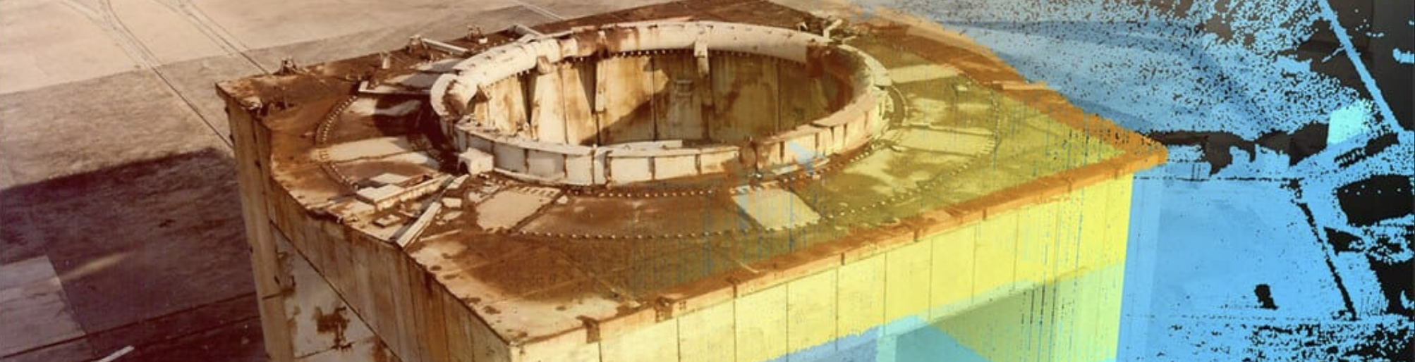
Part of a 3D and imaging survey of the architecture and landscape of LC26. Sponsored by Space Launch Delta 45, Cape Canaveral Space Force Station and Argonne National Laboratory.
Alt Text
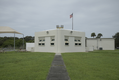
A white building with a flagpole and an American flag on top, surrounded by a grassy area. The building has multiple windows, some of which are angled upward, and a flat roof. Picnic tables underneath a fabric cover are seen to the left of the building.
Keywords
Launch complexes (Astronautics), Canaveral, Cape (Fla. : Cape), Cold War, Space stations, Explorer satellites, Explorer 1 (Artificial satellite)--Orbit
Extent
1 color photograph; DSLR; 21.1 MB
Subject: geographic
Brevard County (Fla.); Canaveral, Cape (Fla. : Cape)
Physical Collection
Cape Canaveral Space Force Station
Note
Related Publications: Collins, Lori; Doering, Travis; and Gonzalez, Jorge, "3D Digital Documentation of Historic Launch Complex Structures at CCAFS: A Workflow Methodology for DOD Cultural Resources" (2017). Center for Digital Heritage and Geospatial Information Faculty and Staff Publications. 20. https://digitalcommons.usf.edu/dhhc_facpub/20 Related Published Content: https://skfb.ly/oQZnP and https://skfb.ly/or9PZ and https://skfb.ly/opSFC and https://arcweb.forest.usf.edu/dhhc/CCSFSLaunchComplexTour/ and https://arcg.is/1OSqi01 and https://vimeo.com/365904796
Recommended Citation
USF Center for Digital Heritage and Geospatial Information, "Looking from Cableway West Back at Blockhouse" (2020). Historic Launch Complexes Photos. Image 28.
https://digitalcommons.usf.edu/cdhgi_cape_canaveral_photos/28
Keywords
Launch complexes (Astronautics), Canaveral, Cape (Fla. : Cape), Cold War, Space stations, Explorer satellites, Explorer 1 (Artificial satellite)--Orbit
