
Andean Archaeological Data Project - Images
Files
Download Full Text (2.5 MB)
Preview
Creation Date
2014
Alt Text
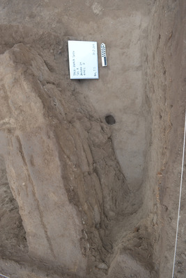
An archaeological excavation site with a rectangular section of soil marked by strings and stakes, featuring a blue tarp partially covering the area. The ground shows various disturbances and barely exposed stones. There is a sign visible in the far corner of the site with a measurement tool beside it.
Keywords
Archaeology
Extent
1 color photograph
Subject: geographic
South America; Perú; Ica (Perú : Region); Huaca Soto (Perú); Chincha Alta (Perú)
Media Type
Color photographs
Format
Digital Only
Identifier
H66-00093-00001
Creative Commons

This work is licensed under a Creative Commons Attribution-Noncommercial-No Derivative Works 3.0 License.
Recommended Citation
Stanish, Charles, "Bottom of Lvl 1 U20 Outside Structure with Posthole" (2014). Andean Archaeological Data Project - Images. Image 169.
https://digitalcommons.usf.edu/andean_adp/169
Keywords
Archaeology
