
Karst in 3D
-

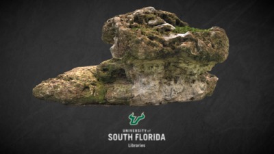
Multi-ton Limestone Rock
University of South Florida Libraries
Part of the University of South Florida Geopark, this multi-ton limerock formation is a sample of Ocala Limestone.
-

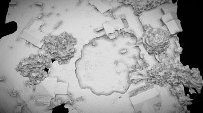
2017 07 18 Sink Hole Simplified 3d Mesh
University of South Florida Libraries
3D mesh of Pasco County sinkhole data derived from drone imagery and .obj file provided by Halo Imaging of Riverview, Florida to the University of South Florida Libraries. HALO is flying with the RTK enabled Ebee plus with the S.O.D.A. camera as well as the Parrot Sequoia MSI sensor. This is from the first day of aerial drone mapping survey performed four days post-event.
-

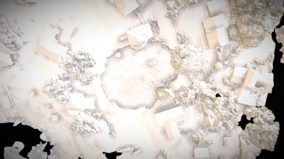
2017 07 19 Sinkhole Simplified 3d Mesh
University of South Florida Libraries
Pasco County sinkhole in Land O Lakes, FL 3D mesh created from drone photogrammetry data acquired by Halo Imaging and shared with the USF Libraries. This is from the second day of aerial survey information, performed five days post event beginning. HALO is flying with the RTK enabled Ebee plus with the S.O.D.A. camera as well as the Parrot Sequoia MSI sensor.
-

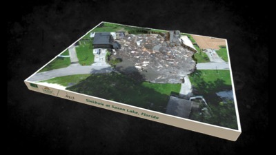
Florida Sinkhole Disaster
University of South Florida Libraries
On July 25, 2017, University of South Florida Library’s Digital Heritage and Humanities Collections (DHHC) researchers conducted a 3D survey of the Pasco County sinkhole near Saxon Lake. We are also working to integrate data with collaboration from the USF School of Geosciences, who were collecting Ground Penetrating Radar survey data in conjunction with our GPS work. Additionally, Halo Imaging have been providing access to their RTK drone imagery that has been collected on multiple days and is allowing for meaningful comparison data. The DHHC and USF Libraries are creating a database archive of this research effort, and a web application portal that shares historic maps and information about the environmental history of this area (see: http://arcg.is/0LuCnL ). To learn more: http://wusfnews.wusf.usf.edu/post/studying-pasco-sinkhole-has-personal-professional-meaning-usf-researcher#stream/0
-

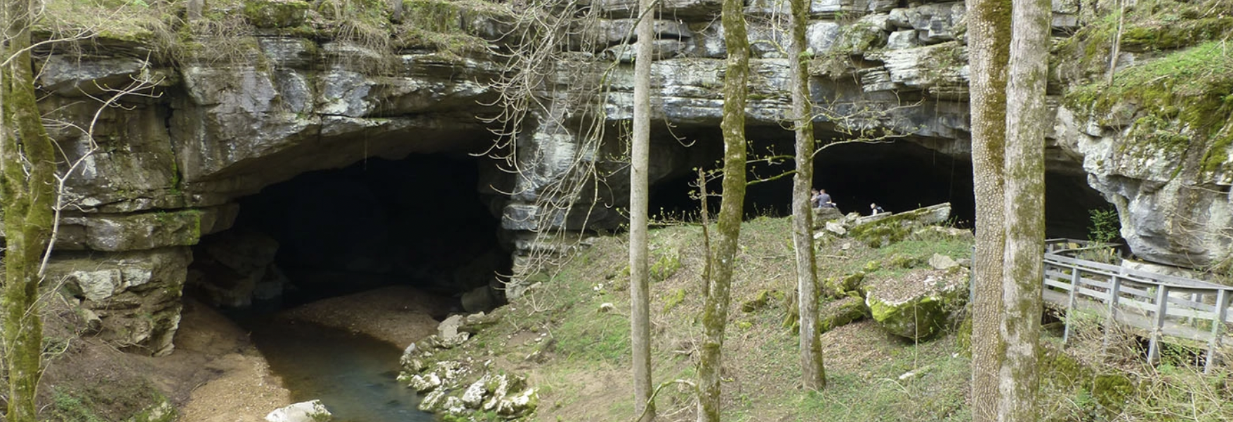
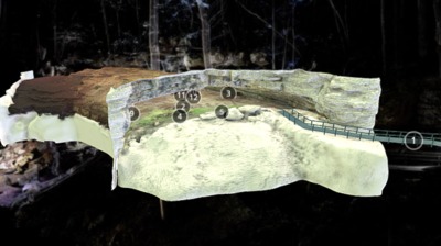
Russell Cave National Monument VR Tour
University of South Florida Libraries
This archeological cave site in Alabama is a National Monument and is manged by the National Park Service. The site is facing concerns from erosion, climate change, and developmental pressures and urban land use change nearby.
The University of South Florida’s Digital Humanities and Heritage Collections team worked with the Southeast Archeological Center from the National Park Service, to digitally document the cave environs using the latest in 3D technologies and spatial survey. The results from our research are combined with geophysical survey information, and are providing the basis for impact assessment and condition survey that will allow for stabilization and long term preservation of this fragile and important site.
-

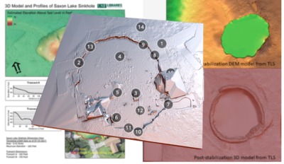
Saxon Lake Sinkhole 3D Laser Scanning Model
University of South Florida Libraries
On July 25, 2017, University of South Florida Library’s Digital Heritage and Humanities Collections (DHHC) researchers conducted a 3D survey of the Pasco County sinkhole near Saxon Lake. We are also working to integrate data with collaboration from the USF School of Geosciences, who were collecting Ground Penetrating Radar survey data in conjunction with our GPS work. Additionally, Halo Imaging have been providing access to their RTK drone imagery that has been collected on multiple days and is allowing for meaningful comparison data. The DHHC and USF Libraries are creating a database archive of this research effort, and a web application portal that shares historic maps and information about the environmental history of this area (see: http://arcg.is/0LuCnL ).
To learn more: http://wusfnews.wusf.usf.edu/post/studying-pasco-sinkhole-has-personal-professional-meaning-usf-researcher#stream/0
-

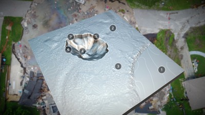
Saxon Lake Sinkhole Depth Model
University of South Florida Libraries
University of South Florida Library’s Digital Heritage and Humanities Collections (DHHC) researchers have conducted 3D surveys of the Pasco County sinkhole near Saxon Lake. As part of our work, we incorporated depth values obtained by CERES Environmental, Inc. in our model. These depth values were acquired from a survey using a hand depth probe. We converted their reported depth values into GIS locations that were integrated into our model.
-

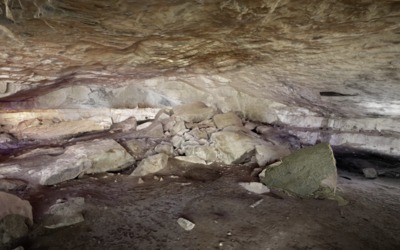
Rock Outcrop with Carving, Russell Cave
University of South Florida Libraries
This rock area was digitized using an Artec 3D laser scanner as part of a 3D terrestrial LiDAR and spatial documentation survey of the Russell Cave National Monument site in Alabama. Russell Cave is an archaeological site with one of the most complete records of prehistoric cultures in the Southeast, dating from 10,000 B.C. to 1650 A.D.
The rock surface has carved elements and writing that are hard to discern. The upper right hand portion of the rock was found to have the number 34 carved on the surface.
We are working with the National Park Service to provide detail topographic documentation of the entire rock shelter site in an effort to better understand and preserve the cave and its cultural resources. The cave has experienced impacts from erosion and modifications that have occurred to the site. The 3D survey will help managers and archaeologists better protect these fragile karst resources.
