
Early Printed Map Collection
Alternative Title
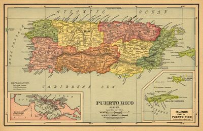
Rand, McNally & Co.'s 11 x 14 new map of Puerto Rico
Files
Download
Download Full Text (3.9 MB)
Preview
Publisher
Rand McNally ( Chicago )
Time Period
c1898
Geographic Location
Puerto Rico
Scale
601920, Scale [ca. 1:601,920]. 9.5 mi. = 1 in. 13.5 km. = 1 in.
Coordinates
18.5 x -67, 17.5 x -67, 17.5 x -65.5, 18.5 x -65.5 ( Map Coverage )
Physical Collection
Early Printed Map collection (Rare Maps)
Holding Location
University of South Florida
Language
English
Media Type
cartographic
Format
Map
Identifier
U16-0063
Recommended Citation
Rand McNally and Company, "Puerto Rico" (2021). Early Printed Map Collection. Image 4.
https://digitalcommons.usf.edu/fl_maps_early/4
Rights Statement

